Google+

Saturday, July 14, 2012

Village Precinct - Northern Perimeter Trail

BIRT- Village Northern Perimeter Trail
            Grade 2 difficulty but no directional signs.
           1.2 km (one way) 25 minutes or
           allow 50 minutes for the return walk
           so that you can read the interpretive signage
           alongside the car park at the lake.

The trail commences without fanfare at this "Road Narrows" sign at the northern edge of the village


The trail down the slope is barred by a steel pipe barrier. This is obviously designed to deny access to motor bikes and vehicles but allow recreational walkers to enter.


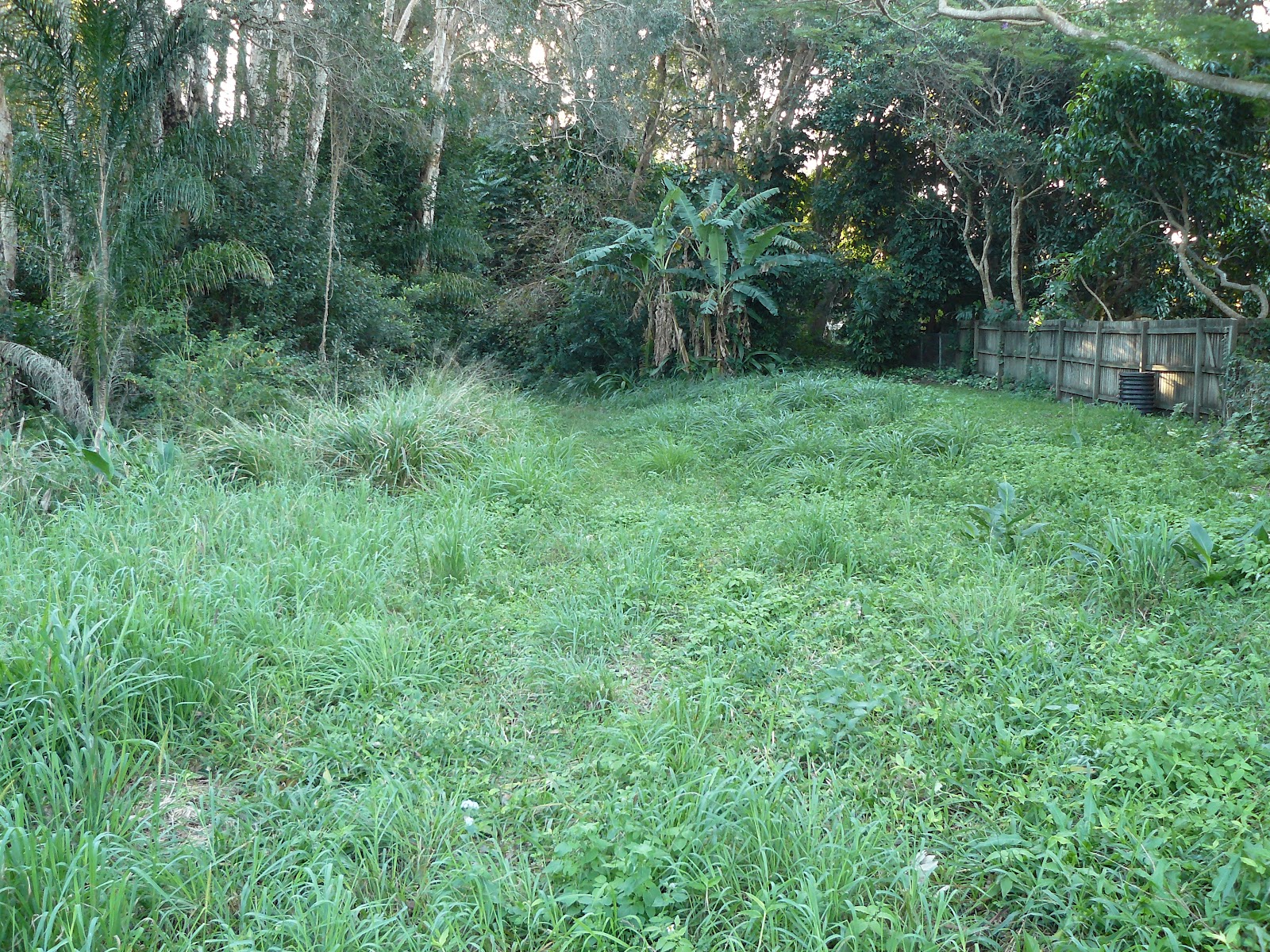
Close to the Tweed Coast Road the residents keep the buffer zone in neatly trimmed condition
While residents are happy to do the work National Parks and Wildlife are rigorous in ensuring that no dogs are allowed to walk this trail. A $300 fine is a fair deterrent.


Fire damage from 2009 fires is still evident but the biodiversity of this region ensures quick recovery
 
 
The grasses make a quick recovery


Work on the drainage in this area is almost finished. (July 2012) Pipes have been laid under this area and grass should be regrowing quite soon. This clump of trees will often reveal a koala and credit to NPWS for ensuring these trees were not felled.


The newly laid pipes are directing the water from the Tamarind Avenue area into the Cudgen Nature Reserve


Some pinus species have grown in this region probably regenerated by seed dispersed by birds. The grass understory is home to an amazing variety of finches


The grassed area adjacent to the Lakeside Apartments is private property so I veered slightly north westerly toward Cudgen Lake.


This trail should be discussed with NPWS. There are some bollards ensuring walkers do not continue toward Camp Wolumbin so I went to the edge of the lake and then around the southern shore.
 
 
A joy to spend some time with this serenity


A view includes Woolumbin on the clear days


Lake views


The purple swamp hen


A very wary spoonbill (2 seconds later it was airborne)


The carpark at the end of the Trail has some interpretive signage and its worth going a few extra metres to view the connection from the lake to the Friday Island canal. A wonderful kayaking area.

Friday, July 13, 2012

Village Precinct - Western Fire Buffer Trail


Western edge of the village - Western fire buffer trail

800 metres
10 minutes one way
Flat
Formed Track but can be overgrown after wet weather
No signage
No experience required


View BIRT Village western buffer trail in a larger map


If driving to commence this walk there is a nice clearing at the end of Poinciana Avenue suitable for parking. This gate is not connected to a fence so it is just barring vehicles from heading south.


Heading south there is a clear wide track with a little creek hopping sometimes required


Someone does some maintenance


This pond attracts a variety of bird life


This gate with adjacent fencing is padlocked and unless you want to climb and risk wet boots is an impediment to the zone further to the south.


Heading north from Poinciana Ave the buffer zone is trimmed by one of the adjoining residents


A few climbers have escaped into the coastal reserve


This reserve allows access to or from Kurrajong Ave (between House No 32 and No 34)


On this day after quite a wet period the grass could have been slashed but I am sure the council is reluctant to risk getting bogged.


Some residents are enjoying the adjacent fire buffer zone


The trail heads to its end


This gate at the Clothiers Creek Road end is not padlocked


These signs are directly opposite the gate to the Western fire buffer trail on Clothiers Creek road


Thursday, July 5, 2012

Meeting Minutes 3 July 2012

Attending


  1. Mike
  2. Ron
  3. Elaine
  4. Faye
  5. Anthony

Apologies 

  1. Luke Porter

Purpose of Meeting

To Review progress on past actions, discuss any new issues or information and decide next steps.

Past Actions

  1. Locate current maps produced by NPWS "Cudgen Nature Reserve Plan of Management" - Graeme Waugh. (Complete - See images in 17 June Minutes) 
  2. Locate Rural Fire Service Trail Maps for area - Anthony Idle (Complete - consulted local fiery and they said they use the Topographical Maps rather than dedicated maps)
  3. Locate Maps of areas from Tweed Shire Council - Ron Hankin (Complete - Ron found some really simple examples of Walk Guide brochures at the Tweed Council, plus copies of cycleway maps. The cycleway maps seem incomplete and really don't form a circuit. They are also only concrete / bitumen style cycleways.) 
  4. Buy a topographical map of area - Anthony Idle (Complete - bought two copies if anyone needs to borrow / use just ask)
  5. Discuss location of Cudgen Lake trails with Magpie - Luke Porter (Luke is organising a meeting with Lake Precinct people and Magpie for a couple of weeks time on a Saturday morning.)
  6. Map out existing trails around the village - Mike Stanley (Mostly complete)
  7. Map the trails in the Western precinct - Luke Porter (Not sure how far have got.)
  8. Map the trails in the Southern Precinct - Elaine Hankin (Complete except for one along behind dunes)
  9. List up points of interest / significance to add to maps to ensure connection to trail network - All (Action point for all below)
  10. Distribute phone numbers and email addresses to start sharing information of who is doing what / when - Anthony Idle (Complete as per list)
  11. Create a place to share information on the web for access by team. Anthony Idle (Complete - Blog at http://cabatrails.blogspot.com.au/ - I will train people how to use this.) 
  12. Attend round table meeting with Wollumbin and Envirocentre groups. (Luke to organise)
  13. Type up minutes from meeting. Anthony Idle (Someone else's turn next ;-)

News & Info

Lakes Precinct 

  • Intend to organise a joint meeting with Camp Wollumbin group shortly.
  • Groups preferred date time is 10 am on 14 July. Alternative is 21st.
  • Caretaker of Camp Wollumbin is Dave the Club's greenskeeper.

Western Precinct

  • -

Village Precinct

  • Mike reported that there is access pretty much from behind the pond between Poinciana and Penda Ct all the way north to Clothiers Creek Rd.
  • Luke & Nick said there was possible funding available immediately through the Lions club if we want to do something with the trail between Pandanus Parade and Norries Headland. 
  • Agreed would be good to walk this trail the same day walk Camp Wollumbin trails.

Southern Precinct

Admin / General

  • There is another community group operating that has trails information.
  • Community Group Steering Committee meeting tonight Tues 3 July.

Next Steps / Follow Up Actions

Lakes Precinct

  • Luke Porter to organise joint meeting and walk on Lakes trails.

Western Precinct

  • Luke to map western trails.

Village Precinct

  • Mike to map western boundary.
  • Everyone to meet together when do Camp Wollumbin & Pandanus to Norries Headland walks.

Southern Precinct

  • Anthony to map the trail behind the dunes off the Goanna track.

Admin / General

  • All - list up a comprehensive points of interest list and description that we can cut and paste into a brochure plus plot on maps to ensure connected to an integrated trail network. 
  • Anthony to add access to the blog for Faye
  • Elaine to try and locate the history book relating to the Cudgen / Bogangar area via school / library network.
  • Anthony to touch base with the Tweed Historical Society to see where we get info and photos for Bogangar area.
  • Luke to report back from steering committee meeting what is happening with other community groups etc.
  • Anthony to touch base with Kerry re attending other groups meeting.
I think that is it??

I have missed something or got it wrong just let me know and I'll change it.

Next Meeting

Sat 14 at 10 am - Meet at Camp Wollumbin (Luke to Confirm)


Ps Faye - you were already given access but have not yet accepted the invite. It might be in your spam folder. Luke do you need a new invite or want to use a different email address?